AI as a tool to reduce desertification
How artificial intelligence and data can contribute to the study of desertification and more sustainable land management.
The problem of desertification
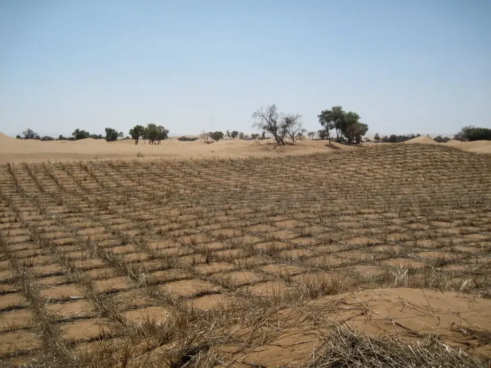
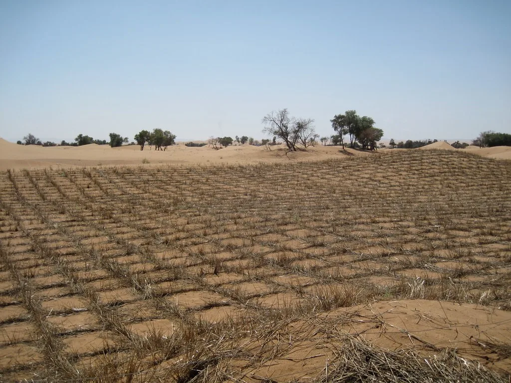
Desertification threatens the livelihoods of many communities, especially people with fewer resources in vulnerable areas. A UNCCD briefing published in 2021 reported that this process threatened the livelihoods of more than one billion people.
Source: UNCCD, land and human health, 2021.
Editorial note, 25 October 2026: the population figure in the original version has been corrected and a source added. The article retains its original 2022 publication context.
Desertification is land degradation in arid, semi-arid and dry sub-humid areas. It can result from climate variations and human activities such as deforestation or overexploitation of resources. It reduces land productivity; preventing and reducing it, and restoring affected areas, requires measures adapted to each context.
Areas at risk include parts of Africa, the United States, South America, Australia and Spain. Addressing the problem requires considering each region’s environmental conditions and political, economic and social decisions.
AI and desertification
Researchers use various AI techniques to analyse data about areas at risk of desertification. Machine-learning methods include k-nearest neighbours (k-NN), random forests (RF) or Support vector machine (SVM). Neural-network models are also used, including the Multilayer perceptron (MLP) or Convolutional Neural Networks (CNN).
Leaving aside the methodologies used for data analysis, we must also consider two types of variables to analyze each of the different situations. Thus, on the one hand we find the biophysical variables and on the other, the socioeconomic variables.
BIOPHYSICAL VARIABLES
–Aridity index
It is calculated as the ratio of annual precipitation to annual potential evapotranspiration. For drylands, the interval from 0.05 to 0.65 covers different aridity classes; it is not the full range of possible index values. Models such as Random Forest and XGBoost, as well as neural networks, can help estimate precipitation and evapotranspiration. Their performance needs to be evaluated in each region.
Water stress of vegetation and state of groundwater reserves:
Convolutional neural networks have been used to complete anomaly data in terrestrial water storage estimation. On the other hand, the use of deep learning with infrared thermal images has also been identified as a very useful technique for the evaluation of water stress of crops and natural vegetation.
–Accurate identification of grasslands and soil organic carbon:
Through the combination of machine and deep learning we manage to detect the vegetation and soil type from the precise results generated from the algorithms.
–Satellite images:
Satellite-image analysis can detect changes in vegetation cover and help map deforestation. Machine-learning models, including deep learning, can also explore where risk might increase, supporting land management.
SOCIO-ECONOMIC VARIABLES
–Population density:
Artificial intelligence can help us quantify producer-consumer commercial networks at a global level and consequently know the impact of the city on the countryside. In addition, images from drones, airplanes or satellites allow us to create precise urban maps that help us predict the expansion of urban territory.
–Associations between average income and desertification:
Satellite imagery and deep learning can help estimate economic indicators. These are approximations that need to be checked against population data and local context.
–Large-scale, irrigated agriculture and overgrazing:
Artificial intelligence is widely applied in different agricultural studies in order to achieve sustainable management of resources to combat desertification.
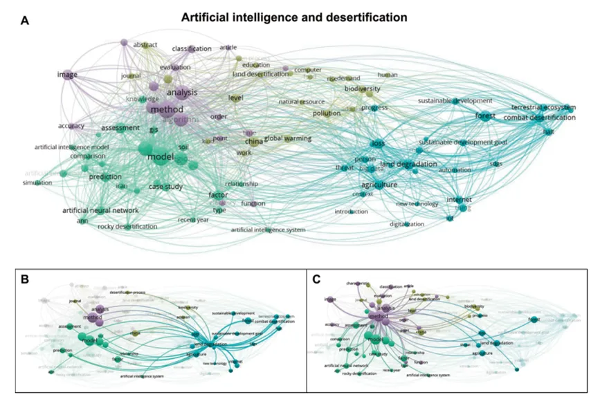
In this figure we can see: A) Conceptual map in relation to “artificial intelligence” + “desertification” in which you can see the links between the terms that currently receive the most attention (until 2020) in the identified scientific publications. B) Connections with “landdegradation”. C) Connections with methods based on artificial intelligence, where “neural networks” can be observed as a term with great importance.
In summary, artificial intelligence applied in the field of desertification allows us to respond to where and when it could occur. However, it should be noted that the study is complex due to the number of factors to be taken into account. We must work synchronously with the different spatial and temporal scales, being aware of the difficulties this entails and also taking into account the biophysical and socioeconomic variables to treat desertification and address the problem it causes. Once we know the impact that these conditions have, we will be able to influence the most appropriate solutions in each of the areas.
Bibliography:
1.-Guirado, E., Martínez-Valderrama, J. 2021. Potential of artificial intelligence to advance the study of desertification. Ecosystems 30(3): 2250. https://doi.org/10.7818/ECOS.2250
Written by
Eva Arnall

Saturdays.AI
Saturdays.AI is an open community for learning artificial intelligence, collaborating and building projects with social impact.
A story from the Saturdays.AI community. Originally published on March 22, 2022.
← More community stories